Project Penobscot
General
Country: | Canada |
Location: | Offshore, Nova Scotia |
Coordinates: | 44°07’46” N / 60°06’00” |
Acquisition: | 1992 |
(Re)processing: | 1992 |
Value added Products: | 2017 |
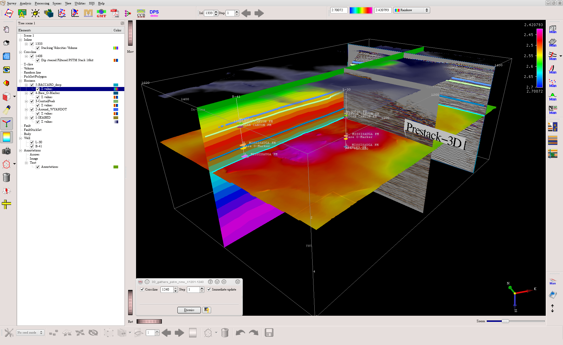
Data summary: | OpendTect project with 3D and 2D Seismic Data, 3D and 2D Prestack Data, Stacking velocities, Wells, Markers, Horizons. |
OpendTect license information: | License key protected parts of OpendTect (OpendTect Pro and the commercial plugins) can be used on this data set without license keys because the software does not check for license key when it runs on this data set. |
Supported for OpendTect: | 6.4.X, 6.6.X, 7.0.0 and onwards |
Size: | 12.4 GB (uncompressed), 8.7 GB (download) |
License: | |
Download: |
|
Original seismic: |
|
Value added products: |
|
|

Acknowledgment
Using the data and value-added products in this project in publications is permitted. We kindly request to be acknowledged in the following manner:
We thank dGB Earth Sciences for making the data available as an OpendTect project via their TerraNubis portal terranubis.com.
Survey Parameters
Survey type: | Both 2D and 3D |
Inline range and step: | 1000, 1600, 1 |
Crossline range and step: | 1000, 1481, 1 |
Z range and step: | 0, 6, 0.004 Time |
Inline bin size (m/line): | 12.5 |
Crossline bin size (m/line): | 25.01 |
Area (sq km): | 90.27 |
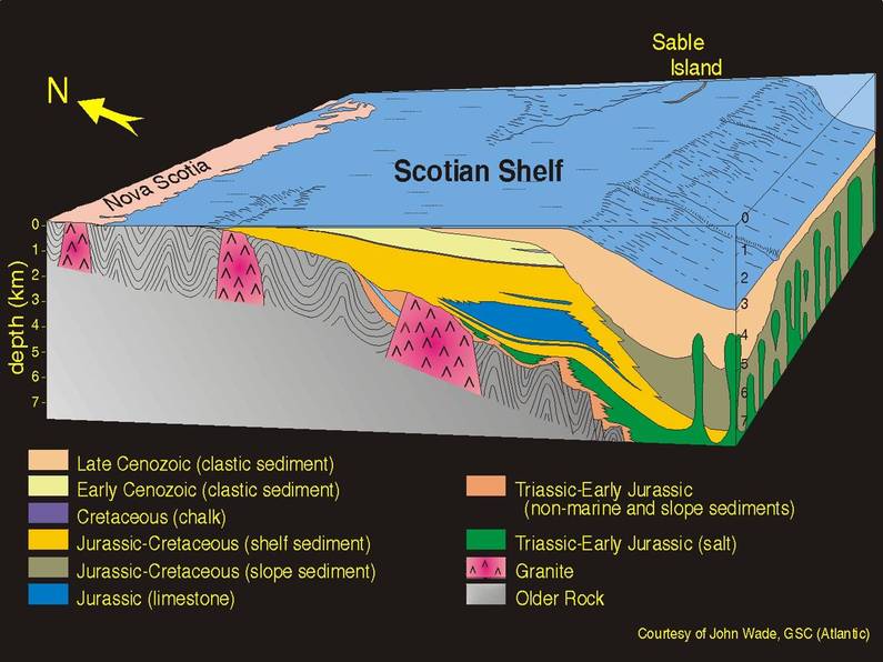
More InfoGeological FeaturesThe data covers many geological features, which include graben bounded faults, channels, mega-scale de-watering faults, reefs, etc. Full Survey Description
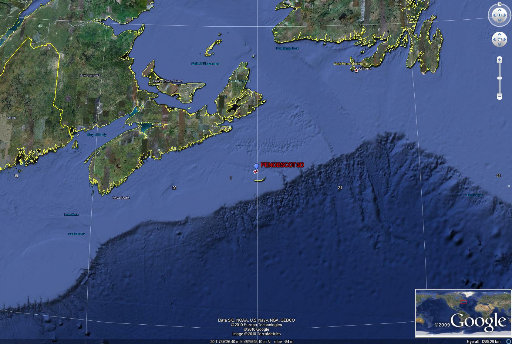
The survey lies in the Scotian shelf (Figure-1), Offshore Canada. It contains several interpreted surfaces and two key wells. The survey contains several structural and stratigraphic features which can be highlighted by OpendTect attributes or advanced plugins. One main advantage of this survey is that it comes with a prestack dataset. You might also notice two major faults within the survey area that form en echelon pattern. These faults mostly displace the interpreted surfaces. Multi-trace similarity, volumetric amplitude or volumetric curvature maps could highlight these features.
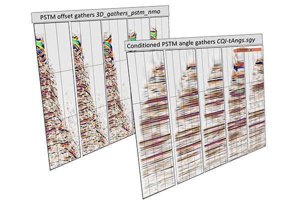
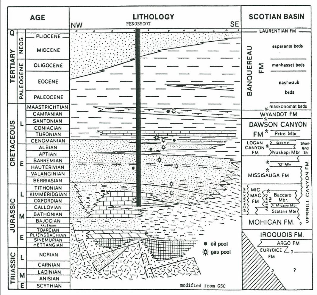
The seismic signal is poor below 3.0 seconds (about 5km). Only two wells, L-30 and B-41, were drilled in the area penetrating Misaine and Baccaro members of Jurassic Abenaki Formation (Figure-2). Several oil and gas fields are located in these Late Jurassic to Cretaceous intervals (http://www.cnsopb.ns.ca/php/cnsopb_assessment_reports.php). The Lower Logan Canyon sands in L-30 were considered oil bearing (minor accumulation). Some of the stratigraphic information is available also in OpendTect (please see the Manage Stratigraphy window in the OpendTect survey). However, the sub intervals of the Lower Logan formation are not mapped in OpendTect. The wells are available in the OpendTect survey, with markers and a time to depth model. The time to depth models have been taken from the CNSOPB report [1]. The survey also contains a limited range of prestack data, which is listed in the Available Data section. |
Referenceshttps://doi.org/10.1190/segam2017-17664850.1 https://doi.org/10.2118/202836-MS https://doi.org/10.1190/segam2017-17742372.1 |
Available Data
Seismic: |
|
2D Seismic: |
|
Horizons: |
|
WellsLogs: |
|
Prestack: |
|
Velocities: |
|
Please use an up to date version of Chrome, Firefox, Edge (on Windows) or Safari (on Mac) |