Project OGA Rockall Trough
General
Country: | United Kingdom |
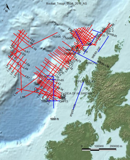
Location: | Offshore, UK Atlantic Margin |
Blocks: | Unknown |
Coordinates: | N 58°17'07.2” / W 7°28'27.0” |
Acquisition: | 2015 |
(Re)processing: | 2015 |
Value added Products: | 2017 |
Data summary: | OpendTect project with 2D Seismic Data, Wells, Horizons, Faults, Gravity and Magnetics data. |
Size: | 12 GB (uncompressed), 11 GB (download) |
License: | Open Government License v3.0 |
Download: |
|
Original seismic: | |
Value added products: |
|
|
|


Acknowledgment
Using the data and value-added products in this project in publications is permitted. We kindly request to be acknowledged in the following manner:
We thank dGB Earth Sciences for making the data available as an OpendTect project via their TerraNubis portal terranubis.com.
Line 25 example
Survey Parameters
Survey type: | Only 2D |
Inline range and step: | 1000, 7550, 1 |
Crossline range and step: | 1000, 6300, 1 |
Z range and step: | 0, 10, 0.004 Time |
Inline bin size (m/line): | 100 |
Crossline bin size (m/line): | 100 |
Area (sq km): | 347268.51 |
More InfoGeological FeaturesStructural interpretation, Seismic Sequence Stratigraphy, ChimneyCube and DHI's. Full Survey DescriptionThe subsurface data is made freely available to support evaluation of the frontier or underexplored UK part of the Rockall Trough (the Atlantic Margin of the UK) under the Open Government License v3.0. The dataset was released in 2016 to stimulate the 29th UK Offshore Licensing Round.
|
References |
Available Data
2D Seismic: |
|
Horizons: |
|
WellsLogs: |
|
Faults: |
|
Please use an up to date version of Chrome, Firefox, Edge (on Windows) or Safari (on Mac) |