Project Delft
General
Country: | The Netherlands |
Location: | Onshore |
Acquisition: | 1985 |
(Re)processing: | 2011 |
Value added Products: | 2021 |
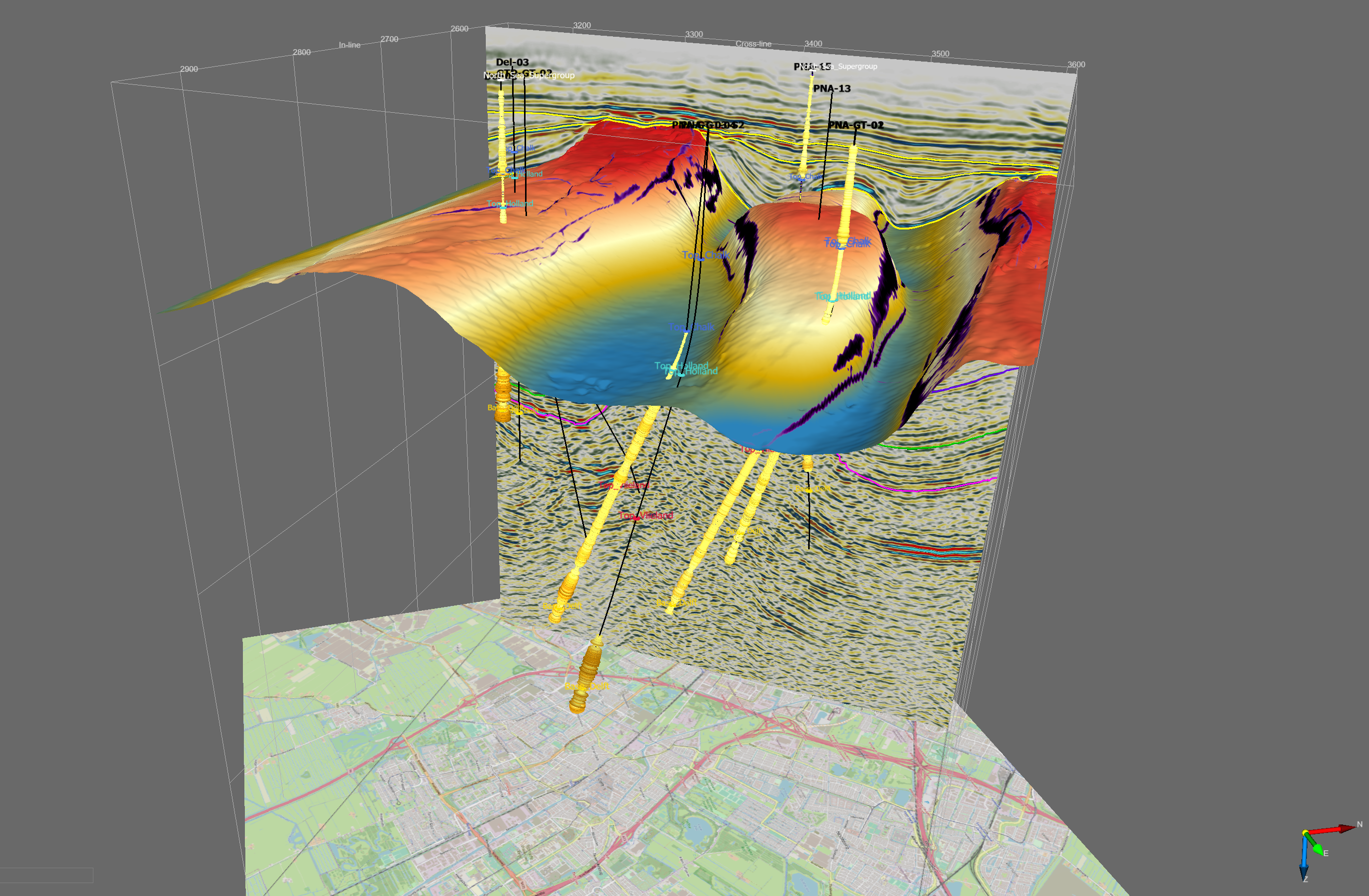
Data summary: | OpendTect project with 3D Seismic Data, Thinned Fault Likelihood volume, Steering Cube with Planarity, Wells, Horizons |
OpendTect license information: | License key protected parts of OpendTect (OpendTect Pro and the commercial plugins) can be used on this data set without license keys because the software does not check for license key when it runs on this data set. |
Supported for OpendTect: | 6.6.4 and onwards |
Size: | 5.4 GB (uncompressed), 2.8 GB (download) |
License: | |
Download: |
|
Original seismic: | |
Original source: | |
Value added products: |
|
Acknowledgment
Using the data and value-added products in this project in publications is permitted. We kindly request to be acknowledged in the following manner:
We thank dGB Earth Sciences for making the data available as an OpendTect project via their TerraNubis portal terranubis.com.
Survey Parameters
Survey type: | Only 3D |
Inline range and step: | 2500, 2950, 1 |
Crossline range and step: | 3139, 3607, 1 |
Z range and step: | 0, 3.8, 0.004 Time |
Inline bin size (m/line): | 20 |
Crossline bin size (m/line): | 20 |
Area (sq km): | 84.6 |
More InfoSeismic data setThe data set is a time-converted subset of a 3D Prestack Depth Migration (PSDM) volume covering the city of Delft in The Netherlands. The data was acquired in 1985 by NAM and re-processed in 2011.The bin-size is 20 m by 20 m and the temporal sampling rate is 4 ms. The data is zero-phase, non-SEG polarity meaning a hard-kick is a negative number. The areal coverage of the subset is 84 km2.
GeologyThe study area is located in the West-Netherlands Basin (WNB), a northwest-southeast trending basin along the northeastern margin of the London-Brabant Massif (DINO, 2019). The basin is bounded by faults in the southwest, against the London-Brabant Massif. The Mid Netherlands Fault Zone separates it from the Broad Fourteens Basin and Central Netherlands Basin to the north and northwest. The basin gradually merges into the Roer Valley Graben (towards the southeast), which has a more NNW-SSE orientation. These two basins overlay the Silesian Campine Basin. During the Triassic, subsidence was possibly related to sediment loading, whereas from the Late Jurassic onwards, extensional faulting became more dominant. In the Late Jurassic to Early Cretaceous, rifting made the basin more pronounced. The absence of Zechstein salt resulted in a characteristic structural style, with Late Jurassic-Early Cretaceous half-grabens in which coastal clastics accumulated. During Late Cretaceous inversion, many of the rift faults were reactivated as reverse faults. Continuing inversion during the Tertiary led to the formation of the Kijkduin High. Oil and gas have been produced in WNB since the 1950s. Oil production is from early Cretaceous sands. Gas is produced from Germanic Triassic sandstones of the Bundsandstein sub-group. Most onshore oil fields in WNB were abandoned around 1994. With the Netherlands’ drive towards renewable energy, the interest in exploring for oil and gas has shifted towards geothermal energy. In the study area, two geothermal systems have been operational since 2010. Both systems produce water with a temperature of 70°C from the Delft Sandstone Member (DSSM), which is a Lower Cretaceous (Valanginian) fluvial sandstone formation. Geothermal energy is used for warming greenhouses. Advanced plans for a 3rd geothermal system exist. The Delft Geothermal Project (DAP) was launched as a demonstration project for solutions to technical challenges posed by the cost-effective development of geothermal systems (Donselaar et al., 2015). The project was initiated in 2007 by students, staff, and alumni of the Department of Geoscience and Engineering at the Delft University of Technology, and evolved into a consortium of governmental and industrial partners. Drilling operations are expected to start in 2020. Geothermal energy extracted from the DSSM reservoir will be used to heat University buildings. |
References |
Available Data
Seismic: |
|
Horizons: |
|
WellsLogs: |
|
More Well Info: |
Please use an up to date version of Chrome, Firefox, Edge (on Windows) or Safari (on Mac) |

